
Best Hikes in Tromsø, Norway: In the City, on Kvaløya, and Beyond
You don't need a car or a full day to find a good hike in Tromsø. Some of the best views in the city are a 20-minute walk from a bus stop. Others take a full day and a bit more stamina. Here's how we'd split them up.
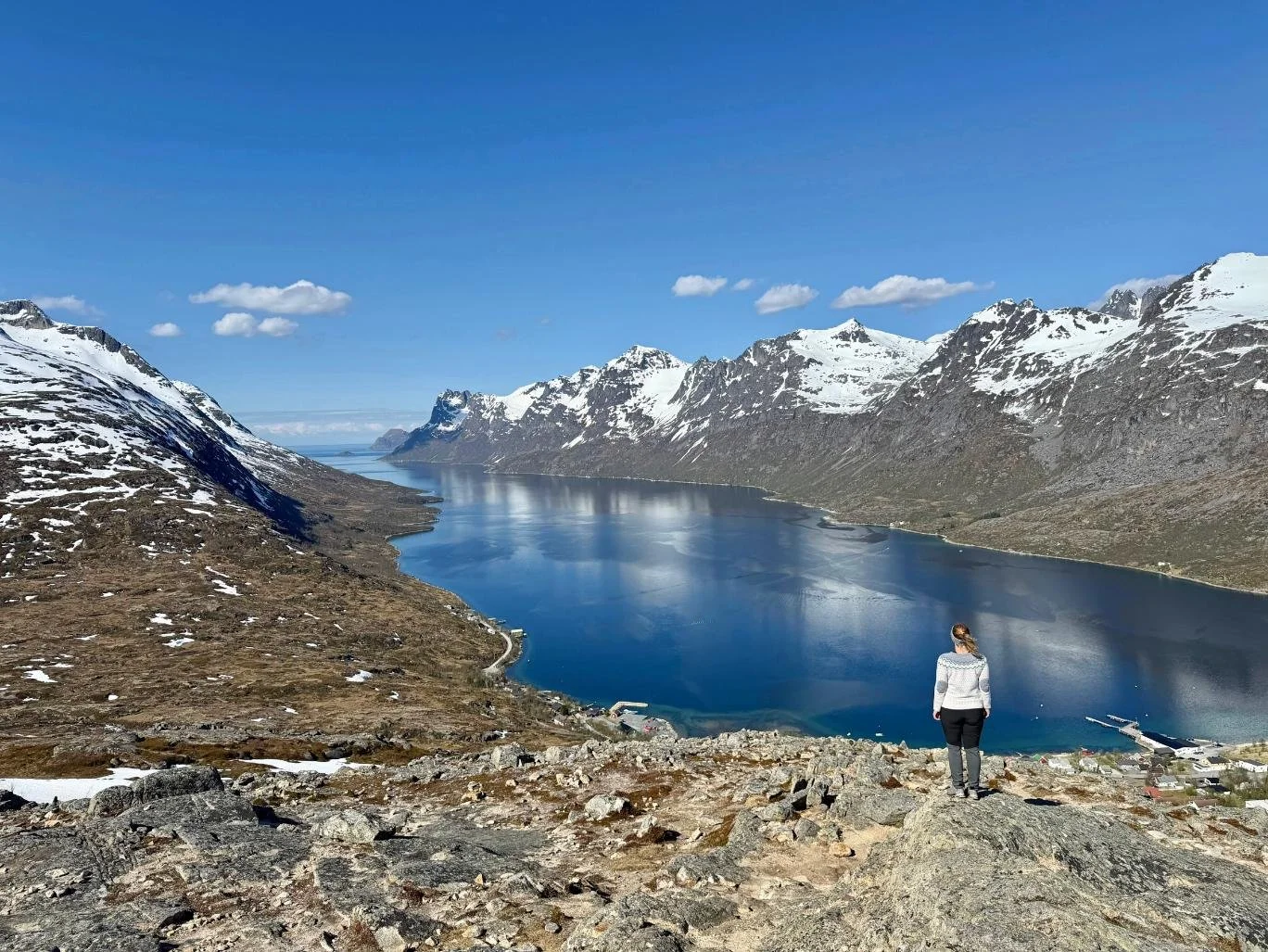
Glorious day hiking Nattmålsfjellet (Kvaløya) in May
Tromsø, Norway, gets treated as a hiking base camp for the Lyngen Alps or Senja, and a lot of visitors never hike anything closer than the cable car queue at Fjellheisen. That's a shame, because the city itself sits between two mountains, backs onto a forested ridge, and is a short drive from an island (Kvaløya) with some of the prettiest and overlooked trails in Northern Norway. This Tromsø hiking guide covers what's walkable from downtown, what's a short drive or bus ride away, and where to go if you want something bigger.
🛌 Where to stay:
• Villa Havblikk, Tromsdalen — we stayed here. Minutes from the Sherpa Steps trailhead, with fjord views and a suite in the original 1917 villa.
• The House of Aurora, Ersfjordbotn — we stayed here. Steps from Kvaløya's best trails, cozy and spotless, with reindeer wandering through in summer.
• Sommarøy Arctic Hotel — beach cabins right by the Ørnfløya trailhead, with a horizon that goes on forever.
🇳🇴 Top experiences:
• Guided snowshoe hike to Fløya — a local guide handles the route and the ride, so you just focus on the climb.
• Guided day hike to Hesten, Senja — a full day out to the summit with the best view of Segla, boat and transport included. We went on a tour with this company.
🚗 Rental cars for the region — worth it for Kvaløya and Sommarøy if you don't want to rely on infrequent buses.
Jump to: In the city · Kvaløya · The mainland coast · Sommarøy · Going bigger: Senja & Lyngen · Trail grading · Practical tips · FAQ
Best hikes in Tromsø: quick answer
For something short and free, the trail up through the forest behind the university is a genuine local favorite, no car needed. For a proper city summit, hike (or take the cable car up to) Fløya, 671 meters above the city, via the 1,203-step Sherpa staircase (which is nothing if you hiked Reinebringen in Lofoten). Tromsdalstinden, the peak that watches over the city from across the bridge, is a full-day, 18-kilometer mountain hike, not a casual outing. For flatter, easier walking, Telegrafbukta and the Folkeparken coastline south of downtown are an easy stroll. If you can drive or are willing to take the bus, Kvaløya has the region's best mid-range hiking, Sommarøy has a couple of short, huge-payoff climbs, and the Lyngen Alps are there if you want real mountains.
In Tromsø city (Tromsøya): hikes you can reach without a car
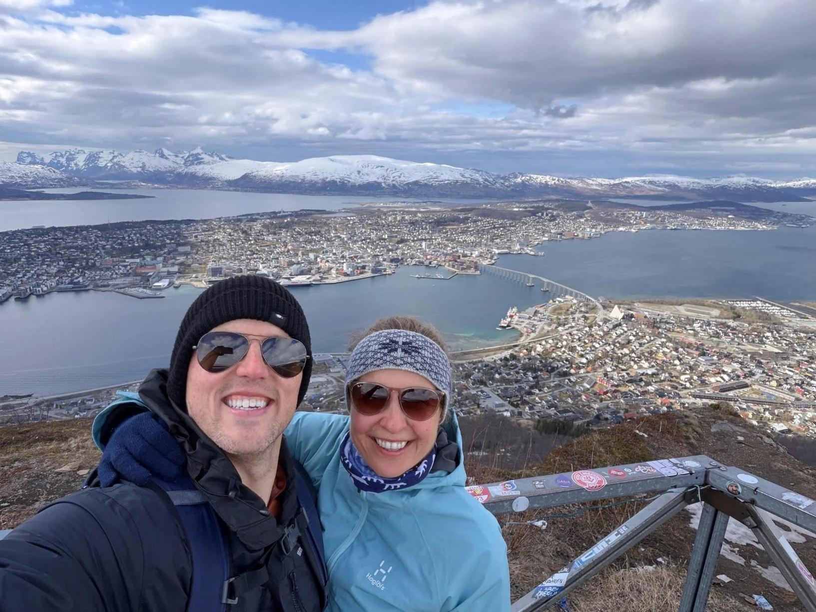
At the top of Fløya early May
The trail behind the university (Vardentoppen)
📍 Near the botanical garden and university
Distance: ~3 km round trip | Elevation gain: ~66 m (summit sits at 419 m, the highest point on Tromsøya) | Time: 30–60 minutes | Difficulty: easy
If you're staying near the university or Breivika, there's a climb into the forest right behind campus that most tourists never find, leading to Vardentoppen. It's the kind of hike locals and students do after work rather than something built for tour buses, which is exactly its appeal. The views are lovely, and you’ll find it hard to believe you’re actually in a city. In winter, it’s a ski trail and a popular spot for northern lights.
Telegrafbukta and the forest loop
📍 Southern tip of Tromsøya, a walk or short bus ride from downtown
Distance: ~7.9 km round trip from the city center | Elevation gain: ~120 m | Time: 1.5–2 hours | Difficulty: easy
This is the flattest, most accessible walk on this list, and one of the nicest ways to spend an afternoon without leaving the city. The route follows what locals call the "Beach Promenade" along the water's edge, then loops through Folkeparken, a stretch of forest and grassland at the southern tip of Tromsøya. Telegrafbukta itself, "Telegraph Bay," takes its name from the first telegraph cable that connected Tromsø to the world, landing here in 1861. You'll pass the Folkeparken Open Air Museum, with a handful of preserved 19th-century wooden buildings, and there's a real beach, a playground, fire pits, and a beach volleyball court if you want to make a full afternoon of it. Watch for eider ducks and cormorants along the shore, and sea eagles overhead.
Fløya: the classic city summit
📍 Tromsdalen (near the Arctic Cathedral), reached via the Sherpa Steps or the cable car
Distance: ~3.5 km round trip via the Sherpa Steps | Elevation gain: ~623 m (summit sits at 671 m) | Time: ~2-3 hours round-trip | Difficulty: moderate (steep, but non-technical without snow)
Fløya is the hike almost every visitor to Tromsø ends up doing. The main route is the Sherpa Steps: 1,203 stone steps built between 2016 and 2019 by a team of Nepali stonemasons (common in Norway), which is also why locals sometimes just call the whole route "the Sherpa stairs." The steps climb to Storsteinen at 421 meters, where the cable car (Fjellheisen) also arrives, so if your legs give out, or you'd rather do one direction on foot and one by cable car, that's a completely normal way to do it. Early May, we had to use crampons to go up, and our bottoms to go down :-)
From Storsteinen it's a further, gentler climb past Steinbøhytta to the true summit of Fløya at 671 meters, with a full panorama over the city, Tromsøya, the surrounding islands, and the fjords. Lovely views, but we personally prefer wilder panoramas without cities.
There's also a longer, quieter alternative through the forest called Dalbergstien for anyone who'd rather skip the crowds on the steps.
Tromsdalstinden: the big mountain
📍 Tromsdalen, across the bridge from downtown Tromsø
Distance: ~18 km round trip | Elevation gain: ~1,160 m | Summit: 1,238 m | Time: ~7 hours | Difficulty: demanding
Locals just call it "Tinden" (the peak), and it's the massive mountain that sits directly across the bridge from the city, visible from almost anywhere in downtown Tromsø. Don't let the closeness fool you: this is a real mountain day, not an extension of the Fløya walk. The route heads into Tromsdalen valley on a wide gravel track, then turns off into forest before climbing the marked route to the summit. It requires a full day, good fitness, and a genuine mountain-weather mindset. The summit is frequently in cloud, fog, or snow even in summer. On a clear day, the payoff is a view that takes in Lyngen, the Kvaløya peaks, and Senja all at once.
Just outside town: hikes on Kvaløya
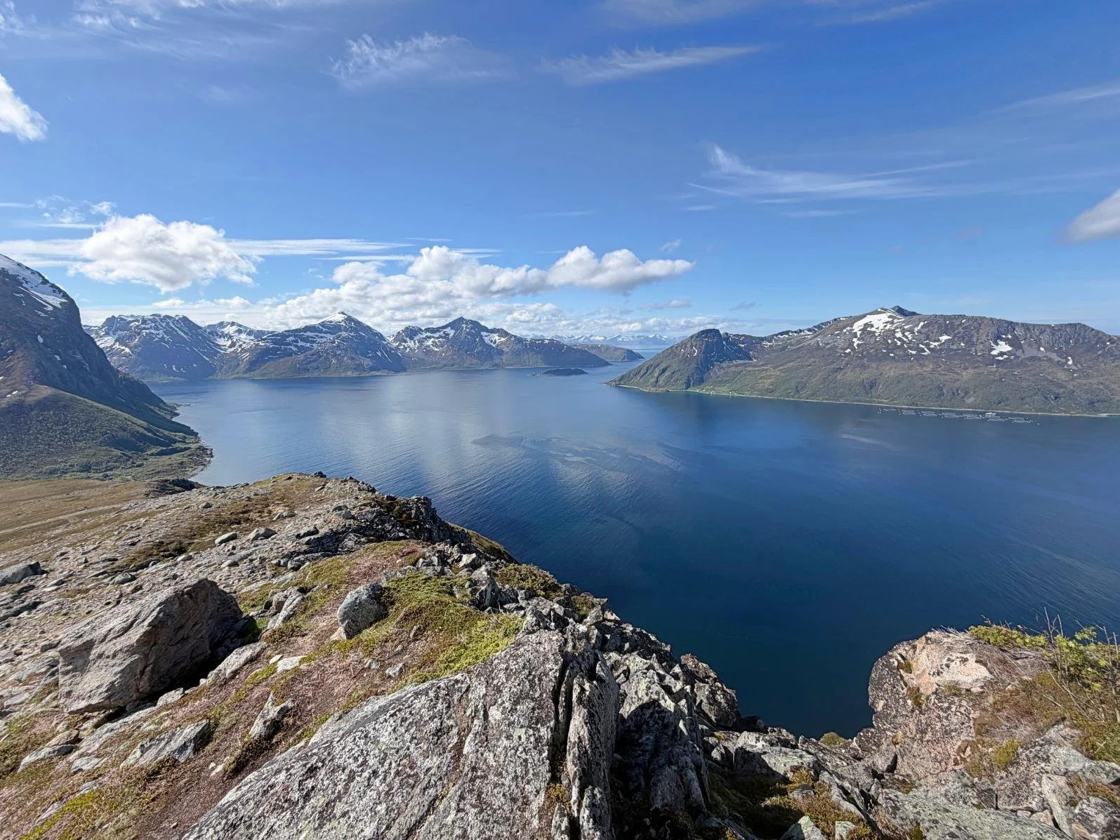
View from Brosmetinden on Kvaløya
Ok, we might be biased here, but we’re in love with Kvaløya. It’s seriously overlooked and a lot wilder than you’d imagine that close to a city as big as Tromsø. Twenty minutes from the airport bridge, Kvaløya has the best mid-distance hiking near Tromsø, and most of it you'll have to yourself (if you’re happy to share with the reindeer :-)). Some of the hikes are reachable by bus, and you’ll need a car for some others (read our guide to renting a car in Tromsø).
We've written a full guide to the island, Kvaløya, Tromsø's Backyard, covering Brosmetinden, Smørstabben, Nattmålsfjellet, and other trails, plus beaches, northern lights spots, and where to stay.
Just outside town: the mainland coast toward Ullsfjorden

The Lyngen Alps viewed from Oldervik, our little corner of paradise
Kvaløya isn't the only direction worth driving. Head northeast from Tromsø along the mainland coast, toward Ullsfjorden, and you hit Movik and Oldervik, two quiet spots that don't get anywhere near the traffic Kvaløya does.
Movik
Movik is a small village around 10 km northeast of Tromsø, along the Tromsøysundet strait, and the trailhead for a route up to Blåkollkoia, a DNT (Norwegian Trekking Association) hut. It's rated a hard hike: roughly 6.6 km one way with about 425 meters of elevation gain, 2 to 2.5 hours each direction. It's a proper mountain outing rather than a stroll, but it's quiet, close to the city, and gives you DNT hut country without a long drive.
For a shorter option, you can hike up to Linken. The trail is wide, very easy, not too steep, and will reward you with beautiful coniferous forests, views over Tromsø, and adorable sheep here and there.
Oldervik
Admittedly, we weren’t sure we wanted to share that one. Oldervik is a small fishing village at the end of the road about 40 km northeast of Tromsø, on the mainland, sitting in a deep valley where the Oldervikelva river meets Ullsfjorden, flanked by two mountains roughly 900 meters high. It's quiet, well off the tourist route, and puts you right at the base of serious mountain terrain (Nonsbu and Trollvassbu trails).
We didn’t hike up the mountains as we had to catch the bus back, but we walked along the sea for a few kilometers and fell in love with the landscape, which reminded us of Vancouver Island and Alaska.
Small hikes on Sommarøy
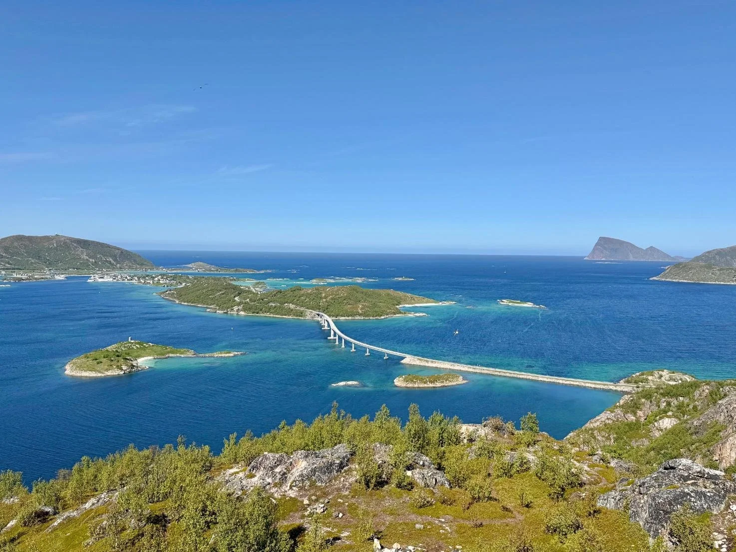
Sommarøy from Ørnfløya, the Caribbean of the north (except the water temp)!
Sommarøy is its own island, connected by bridge past the western tip of Kvaløya, better known for its white-sand beaches than its mountains. But it has one genuinely great short hike:
Ørnfløya
Distance: ~2 km round trip | Time: 40-60 minutes round-trip | Difficulty: easy, though the trail is rocky and can be muddy
The best effort-to-reward ratio on this whole list. Ørnfløya is a short, steady climb up a rocky trail to a 360-degree viewpoint over Sommarøy's scattered islands, fjords, and open sea. It's an easy add-on if you're already out at Sommarøy for the beaches, and doable with kids. Just be aware you won’t be alone on the trail, especially on a sunny Sunday.
Two more worth knowing if you want options: Hillesøytoppen, a small peak on the outer edge of Kvaløya near Sommarøy with a clearly marked path good for families, and Sørviksaksla, a modest hill that's accessible for most fitness levels.
Read our Sommarøy Travel Guide for more.
More challenging hikes from Tromsø

Hiking Hesten for sweeping views of the mighty Segla, on Senja
If everything above starts to feel too tame, two destinations within reach of Tromsø are a different category of mountains entirely.
Senja
Senja, about 2 to 3 hours by car (or a ferry ride from Kvaløya), is Norway's second-largest island and home to some of the most photographed peaks in the country: Segla, Hesten, and Husfjellet among them. These are strenuous, largely unmarked climbs with real exposure near the summits. We've covered them in full in our Senja hiking guide, including trail-by-trail distances, elevation, and difficulty. And for places to stay, explore our favorite hotels & cabins in Senja.
Lyngen
The Lyngen Alps are a couple of hours east of Tromsø, across Ullsfjorden. They hold around 140 glaciers and the highest peak in all of Troms county, Jiehkkevárri, at 1,834 meters. This is where Tromsø's serious ski tourers and alpine hikers go. It's not a casual add-on to a Tromsø city break; it needs its own planning, and for some routes, a guide.
Both are big, technical, unmarked mountains with a serious payoff for people who come prepared, and both deserve more time than a day trip from Tromsø really allows. We included them in our favorite road trips from Tromsø.
Norwegian trail grading

Smørstabben hike on Kvaløya (our tired muscles appreciated the “moderate” grading)
Norway's Trekking Association (DNT) grades trails green (easy, family-friendly), blue (moderate), red (demanding, some mountain experience expected), and black (very demanding, expert terrain). Worth knowing if you're used to hiking grades elsewhere: Norwegian grades tend to run a level harder than what the color implies. A red trail here can involve real scrambling. Whatever the grade says, waterproof boots, a windproof layer, and checking the forecast before you head out are non-negotiable, even on the "easy" walks, since weather on these ridges changes fast.
Also, the low altitude can be deceiving. What would be a gentle 600 m hill in other countries feels like high altitude in the Arctic.
Practical tips for hiking in and around Tromsø

Mid-May, the mountains above Kvaløysletta, on Kvaløya, were still very white!
You don't need a car for everything. The university trail, Telegrafbukta, and Fløya are all reachable on foot or by city bus. Kvaløya, Sommarøy, and the mainland hikes toward Movik and Oldervik are reachable by bus but require planning since buses are infrequent. If you do need a car, see our guide to renting a car in Tromsø.
Weather changes fast, even on short walks. Arctic Norway weather doesn't stay put. A clear morning at Telegrafbukta doesn't guarantee a clear afternoon on Fløya.
Daylight is either endless or nonexistent. In summer, the midnight sun means you can start a hike at 9 p.m. and still have full daylight. In winter, plan around a short window of light and check trail conditions, since several of these routes hold snow and ice well into spring. We highly recommend a guide in winter. Read our guide to the Best Time to Visit Tromsø.
Most trails are lightly marked, not paved. Download an offline map before heading out. The Norwegian UT.no app and AllTrails both cover the main routes around Tromsø.
For everything else in the city, see our full guide to things to see and do in Tromsø, and if you're visiting during the midnight sun season, read our guide to things to do in Tromsø in summer. For a place to stay, check our guide to the best places to stay in Tromsø and around.
Or zoom in and out on the map to find hotels, cabins and apartments in and around Tromsø:
✈️ Find flights
🏨 Explore hotels, apartments, guesthouses, cabins
🧭 Browse activities and tours
🚗 Compare car rentals
🧳 Get travel gear (including our Arctic essentials)
🛡️ Travel safe with Heymondo Travel Insurance (5–15% off)
📱 Get a travel eSIM
🐾 Protect & track Arctic wildlife with Fahlo Bracelets (20% off)
FAQ: Hiking in Tromsø, Norway
What is the best hike in Tromsø? For a short, free, local-favorite walk, it's the forest trail behind the university. For the classic city-summit hike, it's Fløya via the Sherpa Steps. For a full mountain day, it's Tromsdalstinden.
Can you hike in Tromsø without a car? Yes, for several of the best options. The university trail, Telegrafbukta, and Fløya are all reachable on foot or by city bus. You'll need a car (or a tour) for Kvaløya, Sommarøy, and the mainland hikes toward Movik and Oldervik.
How hard is the hike to Fløya? Demanding, but non-technical. The full route from the trailhead near the Arctic Cathedral to the true 671-meter summit is about 6.3 km round trip with roughly 620 meters of elevation gain, and takes most people 3.5 to 4 hours round trip. If you just want the classic view, Storsteinen (421 m), where the Sherpa Steps meet the cable car station, is a shorter goal on its own. You can also ride the Fjellheisen cable car partway or the whole way if you'd rather skip the stairs.
Is Tromsdalstinden hard to hike? Yes. It's a full-day mountain hike, around 18 km round trip with roughly 1,160 meters of elevation gain to the 1,238-meter summit. It's doable for a fit, well-prepared hiker but shouldn't be treated as a casual add-on to a city visit.
What's the best hike near Tromsø for a half day? Telegrafbukta and the Folkeparken loop for something flat and easy, or a drive out to Ørnfløya on Sommarøy for a short, high-payoff climb.
Is Kvaløya worth a day trip for hiking? Very much so. It has more variety and far fewer people on the trails than the city-center hikes. See our full Kvaløya guide for specific trails.
When is the best time to hike around Tromsø? June through September for most trails, with July and August giving the most reliable conditions and the midnight sun. Some lower routes, like Telegrafbukta, are walkable year-round; higher routes like Tromsdalstinden and the Kvaløya peaks hold snow well into late spring.
What makes Tromsø different from Senja or Lofoten for hiking is how close everything is from the city. You can do Vardentoppen before breakfast, Fløya after lunch, and still be back in town for dinner, no car, no ferry, no planning required. If you’re not driving, read our guide to Hikes by Bus from Tromsø!
And when that starts to feel too easy, the real mountains are right there waiting: Tromsdalstinden across the bridge, Kvaløya twenty minutes away, and Senja and Lyngen a short drive or ferry beyond that. Most visitors pick one hike and call it a day. Stay a little longer, and Tromsø turns out to have so many more (and prettier) layers than the postcard view from the cable car ever lets on.
If you haven’t figured out transport yet, read our guide: How to get to Tromsø. Finally, explore all our Norway Travel Guides here.

Free download
Travel Cheaper Cheat Sheet
27 tips on flights, hotels, hidden costs and more — spend less without missing what actually matters.
No spam. Unsubscribe anytime.
