
Hiking in Lofoten Islands – Best Trails, Conditions & What to Expect
We’ve hiked these Lofoten trails ourselves. Here’s our trail guide, what the conditions are really like, packing tips, and everything you need before you go. Hiking rarely gets more spectacular than in the Lofoten!
Hiking Reinebringen - worth every step (October)
Last update. June 2026
There's a version of hiking in Lofoten, Norway, that looks great on Instagram — dramatic peaks, mirror-flat fjords, golden midnight light. That version is real, and believe us: hiking rarely gets more spectacular or “grammable” than this. What Instagram leaves out is the sideways rain at the trailhead, the mud that swallows your boot to the ankle, and the summit fog that rolls in the moment you reach the top.
We love it anyway. Hiking the Lofoten Islands is one of the most rewarding things we've done anywhere, and we keep going back. These are the trails we've actually done, with notes on what the conditions are really like — not what they look like in the best-case photo.
If you're still deciding when to go, our best time to visit Lofoten guide covers the seasonal tradeoffs in detail. And if hiking is not your thing or if you want to combine it with other activities, explore our favorite things to do in Lofoten.
Jump to: Before you hike · The trails · Lofoten hiking map & navigation · Winter hiking · What to pack · Where to stay · FAQ
Getting around Lofoten
Rent a car, drive to the trailheads, and wait for the weather to cooperate.
Top Lofoten tours
Find a hiking tour with an experienced guide.
Browse hotels and rorbuer
Find a place to rest after a whole day hiking
Before you hit the trails — What hiking in Lofoten is really like
The light changes everything
Hiking in the Lofoten Islands isn't just about reaching summits. It's about chasing light that doesn't behave like light anywhere else. In summer, climbs cut through mist before you emerge above the clouds into gold. In fall, fresh snow dusts the peaks while the valleys are still green. Even on the same trail twice, you'll get a different experience — which is part of why people come back.
Pack for all seasons, even in July. We're not being dramatic. A morning that starts in sunshine can turn into horizontal sleet by the time you're halfway up. That's Lofoten. It's also what keeps the islands from ever feeling ordinary.
Norwegian trail difficulty — a word of warning
Norwegians are, apparently, born with crampons attached. What a local trail marker calls "easy" is what most of us would call "a solid workout with some mildly terrifying moments." Norwegian hiking time estimates also consistently underestimate how long it takes non-Norwegians — budget extra time on every route.
A few things that hold across almost all the hiking trails in Lofoten: there are very few flat stretches, most popular routes are marked but many others aren't, and exposed ridges are common even on shorter hikes. If heights make you uncomfortable, check individual trail notes carefully before committing.
First-timers should seriously consider booking a guided hike for at least one outing — a good local guide calibrates the experience to your fitness level and knows the conditions on any given day.
Weather strategy
The honest approach to planning hikes in Lofoten is to not plan them too far ahead. Drive to the trailhead. If the weather is bad, wait in the car. Check yr.no — the Norwegian weather service, more accurate for this region than international apps — and watch for the 30-minute clearing windows that often follow a squall. Some of our best summit moments happened because we waited out an hour of rain.

Penguin tip:
yr.no is far more reliable for Lofoten weather than Google or Accuweather. Bookmark it before you go and check it hourly on hiking days — not daily.
We personally enjoy fall hiking — late September into October — when the peaks have fresh snow but the trails are still walkable, and the crowds have gone home. Rainfall increases, but so does the drama.
Best hiking trails in Lofoten
These are the five Lofoten hikes we've done personally. There are other trails in Lofoten worth exploring — Offersøykammen near Nappstraumen is a less-crowded alternative to Reinebringen with a 360-degree summit view and no exposed ridge — but we only write about what we know from experience.
If you love hiking, be warned: Lofoten will ruin every other trail for you. These islands are built for boots and big views — narrow ridgelines, sea-sprayed cliffs, and beaches that appear out of nowhere between peaks.
Note before you put on your hiking shoes: Lofoten is remote, wild, and full of steep surprises — which is exactly why we love it. But a sprained ankle on a ridgeline or a missed ferry thanks to rogue weather can get expensive fast. We always travel with Heymondo Travel Insurance, and you get 5% off (sometimes up to 15%) through our link. It covers hiking, ferries, and even lost luggage full of fish-shaped sweaters. Worth it for peace of mind in the Arctic wild. You might also be interested in our hiking & backpacker travel insurance guide and our travel insurance for Norway guide.
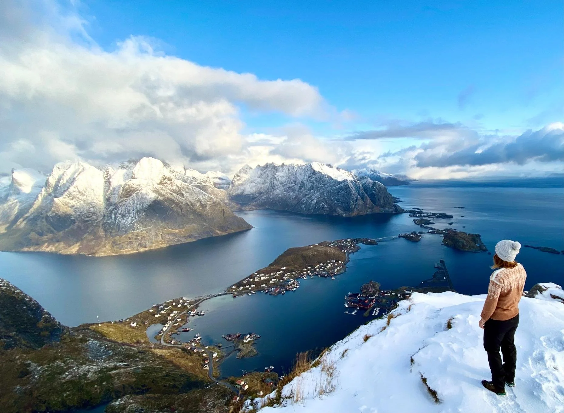
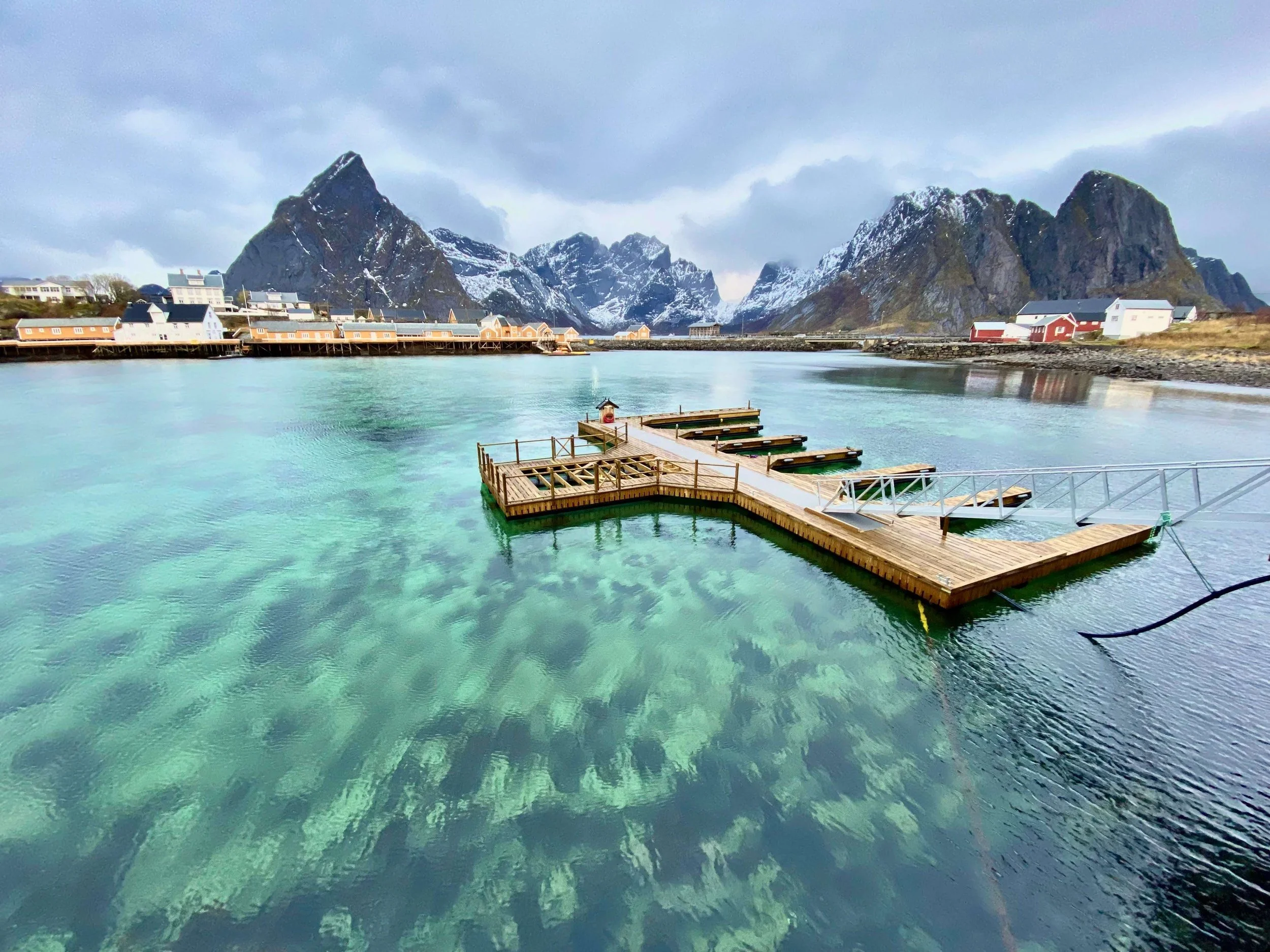
Reinebringen
Distance: 6 km round trip | Elevation gain: ~450 m | Time: 3–3.5 hours
Best for: the iconic Lofoten view, hikers who want to tick the classic

We made it!
You might have seen the view from Reinebringen on social media. It’s just too “wow” not to share, and considered the best hiking in Lofoten.
And the story of this trail is also incredible. A few years back, the hike started to gain popularity, resulting in an impracticable and dangerous path to the top. So, what did Norway do? They hired the most skilled mountaineers in the world. A team of Sherpas built stairs with over 1500 steps — large steps! —, almost all the way to the summit.
Easy, you might think? With an elevation of 448 meters on just 1 kilometer, it’s quite steep. OK, very steep. Ask your calves to let us know how they feel the next day!
And a piece of advice: Stop looking at the number of steps, it doesn’t help!
That being said, if you’re cautious, especially at the top — there’s often snow and ice — you’ll be rewarded with one of the most spectacular views you’ve ever seen.
Important safety note: Make sure to keep up with the last safety recommendations on the trail’s Facebook page. They rarely close the access, but often strongly advise against climbing, especially in winter. There are accidents, so be prepared for any weather and wear proper mountain shoes. We saw a group with sneakers, and it did not end well.
Getting there: Trailhead is at the southern end of the Ramsvik tunnel on the old road. Free parking at the Djupfjord viewpoint (1.3 km west) or paid parking in Reine village for your rental car.
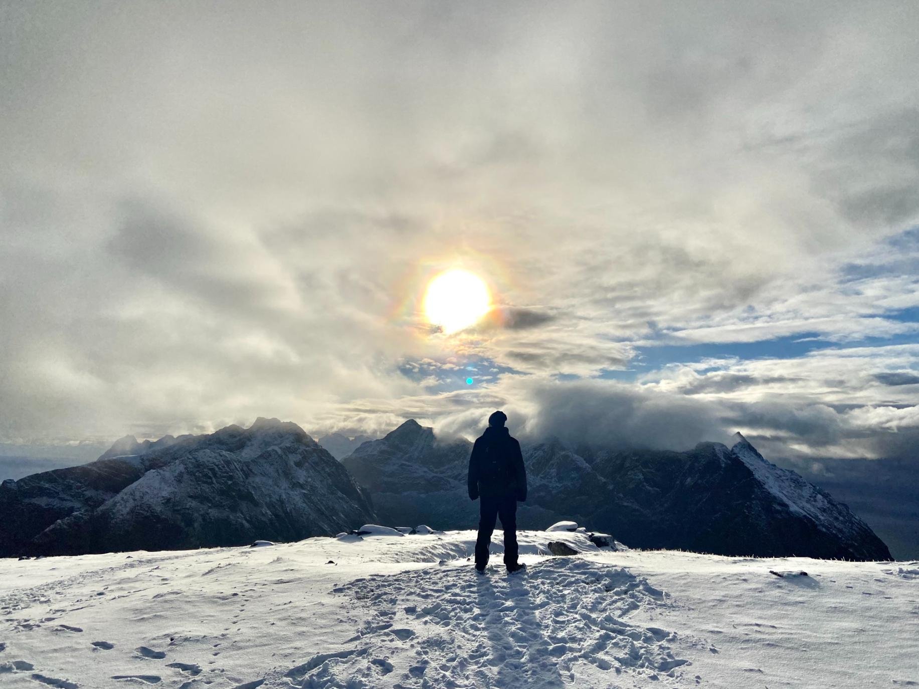
Mount Ryten
Distance: 7–10 km round trip | Elevation gain: ~500–700 m | Time: 3–5 hours
Best for: the world-famous view over Kvalvika Beach, those wanting a longer day out
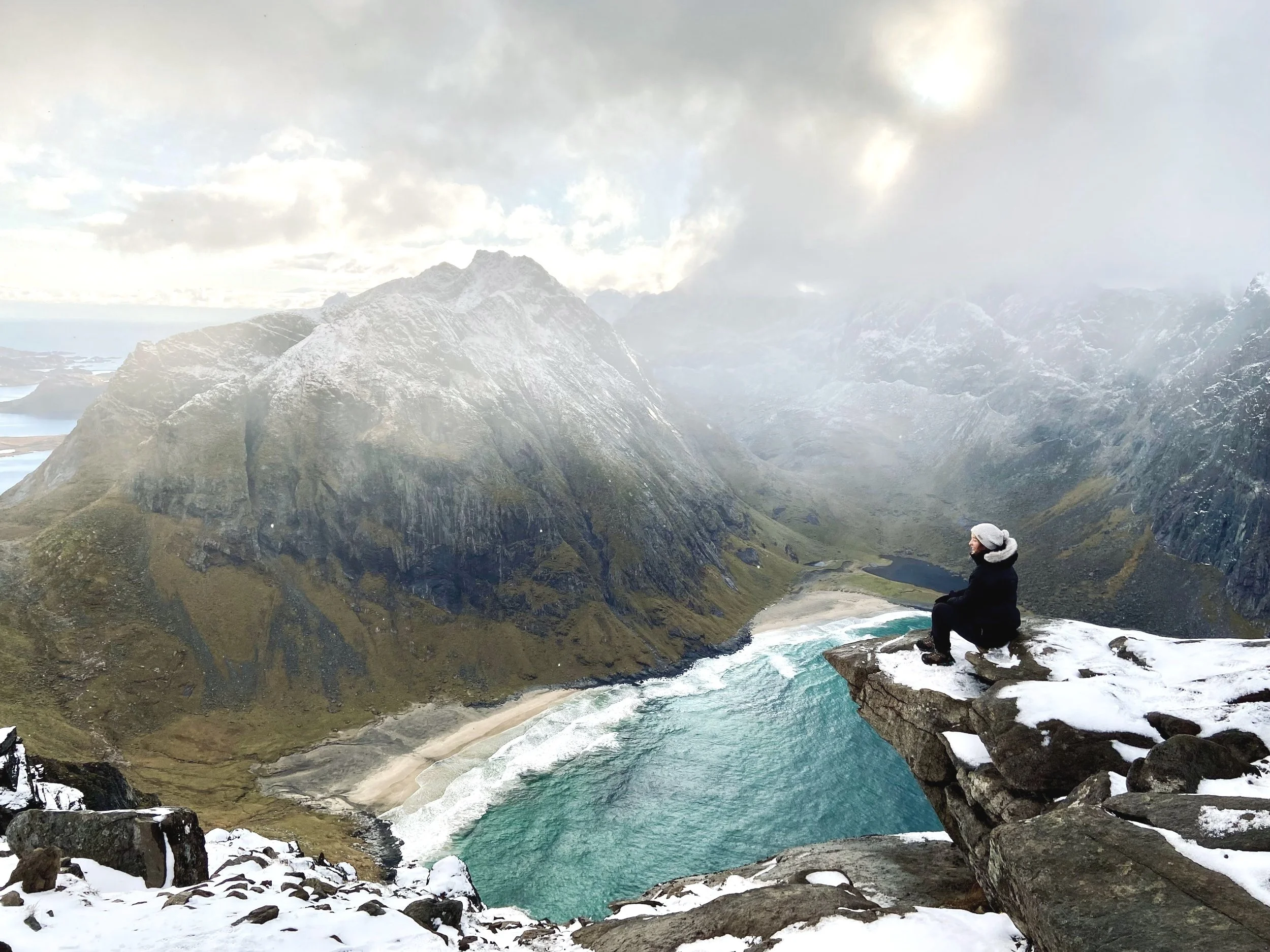
Eli overlooking Kalvika Beach from Mount Ryten. After waiting an hour, the clouds cleared up for the pic!
Aaah, another favorite… and admittedly, one of our favorite views in the world. We’ve done it in summer and fall, and every time, the contrast of colors between the turquoise ocean, the golden sand and the green — or white — slopes is just unreal.
You can hike Mount Ryten solo — allow 4 to 6 hours total, depending on how wet the terrain is — or in a combo with Kvalvika Beach (see below) if the weather is not too bad.
Now part of the Lofotodden National Park, the trails are marked. They weren’t the first time we were there, resulting in an unexpectedly steep climb from the beach!
Just do like the sheep and don’t look down…
Getting there: Innersand parking area (GPS: 68.089147, 13.140483) is the main access point — 100 NOK fee. Alternatively, park 1 km past Fredvang on FV808 at Lomstjonna.
Kvalvika Beach
Distance: 2–3 km one way | Elevation gain: ~180–260 m | Time: 1.5–2 hours each way
Best for: a quieter, shorter option — or pairing with Ryten for a full day
Perfect reflection on our way to Kvalvika Beach ‐ Voted picture of the month by Foap
The trail for Kvalvika Beach typically starts from the parking area at Fredvang (same for Ryten), where you'll find a sign marking the beginning of the hike. Do a favor to the locals and pay attention to the “no parking” signs in front of some houses.
This easy hike usually takes around 2 to 4 hours total, depending on your pace and fitness level, and especially the mud situation.
The trail does ascend — you can’t really avoid that in the Lofoten —, but it’s not very steep.
Once you reach the pass, you'll witness a panoramic view of the beach and the turquoise waters.
Descend to the mighty Kvalvika Beach and spend time relaxing, or continue on to Mount Ryten. It’s also a popular camping spot, so you won’t be alone in summer.
We know the color of the water is inviting — irresistible, Eli would say — but swimming is NOT recommended due to strong currents and waves.
Getting there: Kvalvika Beach parking lot for the direct route (shortest approach), or Innersand parking if combining with Ryten.
Røren
Distance: 3–4 km round trip | Elevation gain: ~295 m | Time: ~2 hours
Best for: first-timers, those wanting an easier hike with still-spectacular views
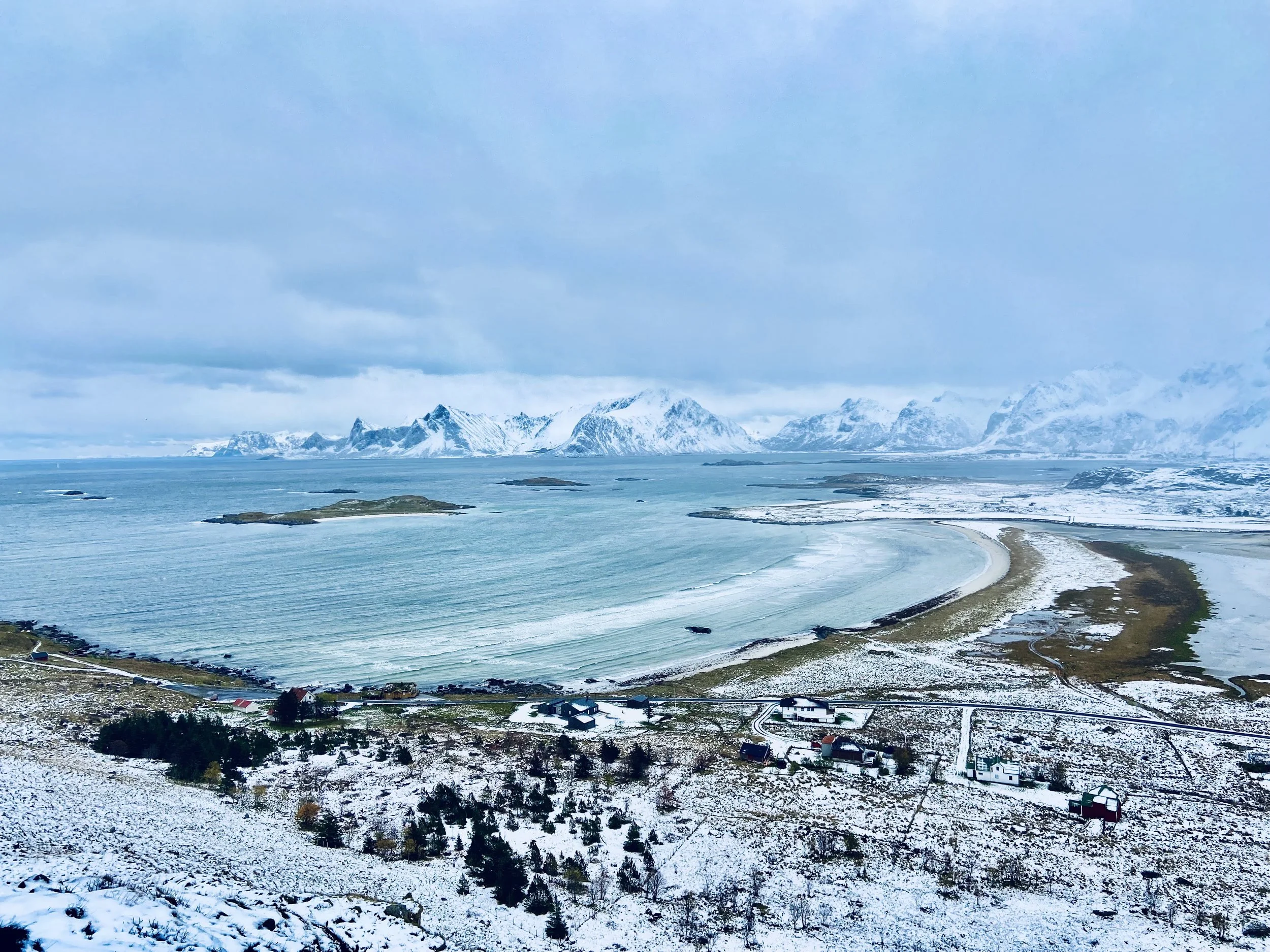
Yttersand Beach in October
Røren/Ytresandheia is a fairly flat ridge, which makes it quite easy for all hiking levels. Allow roughly 2 hours total if the terrain is dry.
Unfortunately, in October, the snow was already so deep that, without snowshoes or skis, we had to turnaround halfway.
After a short ascension, you’ll get stunning views over the Caribbean-looking waters of Yttersand beach and the mountains of Flakstadøy in the distance. A true Lofoten postcard with a limited effort!
Getting there: Yttersand Beach parking area at the end of the road toward Yttersand — don't turn into Fredvang village. Free but limited parking; overflow at Innersand.
Mannen
Distance: 3.5 km round trip | Elevation gain: ~400 m | Time: 2–3 hours
Best for: those based in the northern part of the islands, sunset and midnight sun hiking

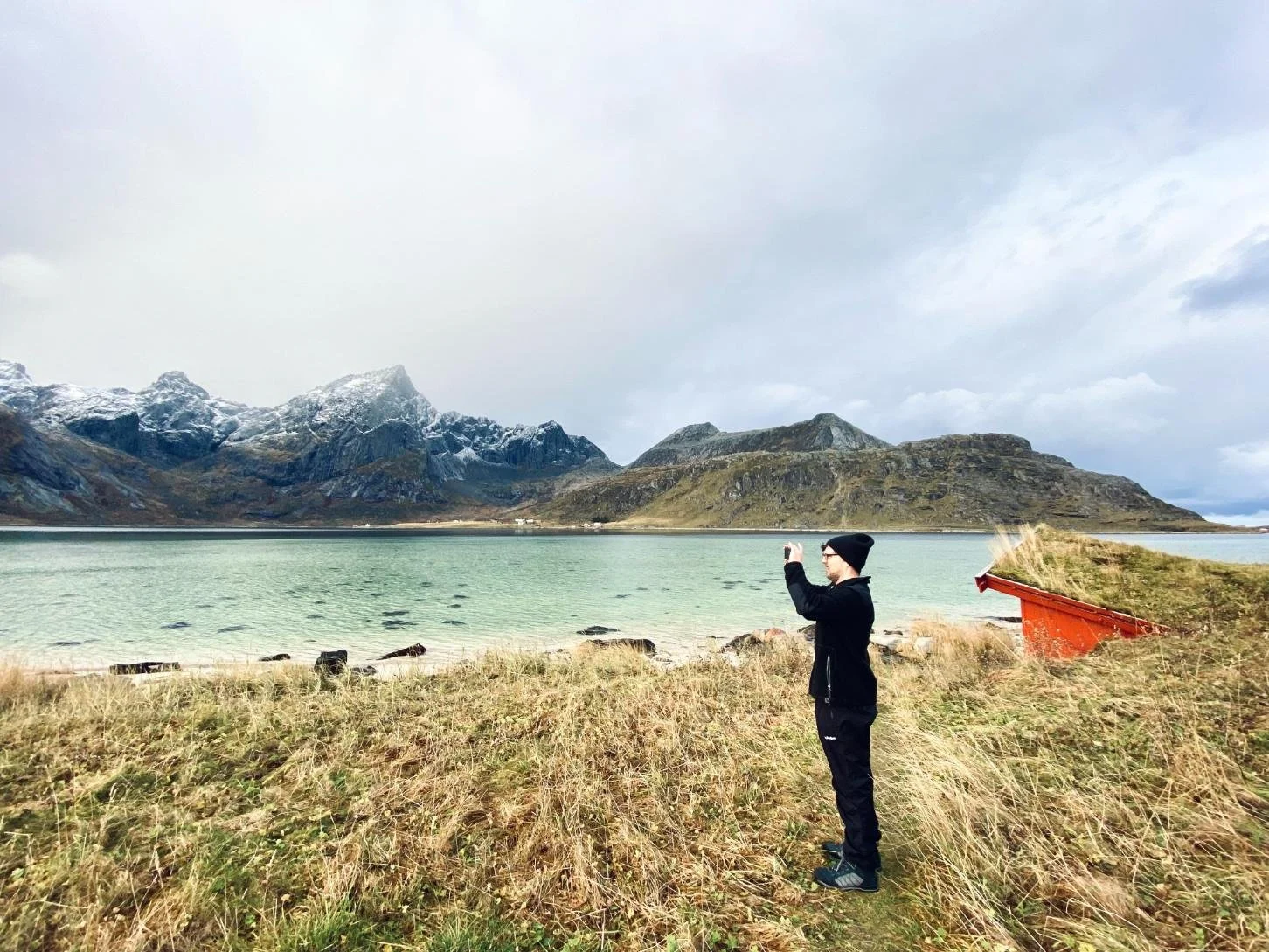
We had to drive across the island to Haukland beach for clear skies but it was worth it!
Another fairly easy hike, and another beautiful beach! Allow roughly 2 to 3 hours total.
Please note that if you have vertigo, some stretches edge very close to steep cliffs.
If you’re lucky to hike Mannen on a sunny day, you’ll have a hard time believing that you’re above the Arctic Circle:Lagoon-looking turquoise waters and impossibly green slopes.
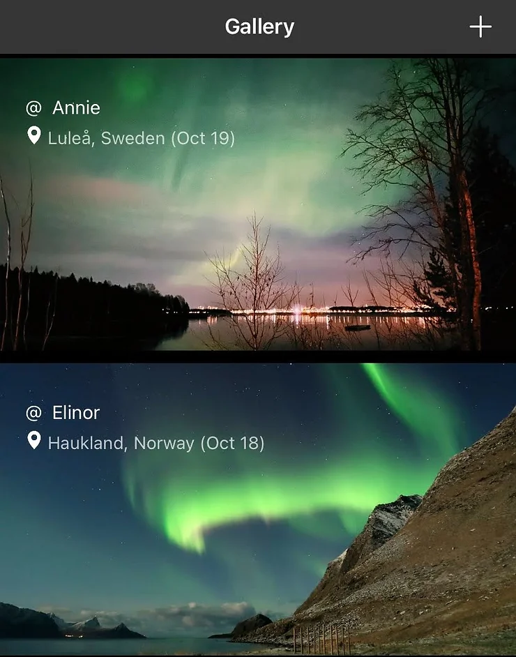
Uttakleiv and Haukland beaches are fantastic spots to watch the Northern Lights, if weather and solar activity allow. One of Eli’s pictures, taken at Haukland beach, was featured in My Aurora App.
Hike it on an icy day, though, and you’ll remember where you are. We even got a lovely snow storm at the top!
Just before the tunnel to Uttakleiv, a sizable parking area for Haukland is available. Mannen can be spotted rising above the tunnel.
Facing Mannen, the trail follows the gently rising ridge on the right side of the summit.
Take in the view: you don’t see this every day!
Getting there: Parking just before the Uttakleiv tunnel on Vestvågøy. Well-signposted from Leknes.
Lofoten hiking map & navigation
Just drive around the islands to find hidden gems!
Cell service in Lofoten is unreliable on trails and essentially nonexistent in parts of Lofotodden National Park. Download an offline map before you leave your accommodation — not when you're at the trailhead wondering why your signal has disappeared.
The best options right now are Organic Maps (fully offline, detailed topographic maps, no ads, free) and AllTrails (good trail-specific data and community notes, offline download requires a paid subscription). Maps.me still works and is familiar to many hikers. For trails that don't appear on the main apps, Mapy.cz covers routes others miss.
The official ut.no platform from the Norwegian Trekking Association also has good Lofoten trail data and is worth checking for routes in national park areas where trail conditions are actively monitored.
Winter hiking in Lofoten
Winter changes the hiking picture in Lofoten significantly — and not just because of the cold. Several popular summer trails become genuinely hazardous without the right gear and experience (Reinebringen in particular), while others transform into something quieter and more dramatic than their summer versions.
Ryten can be hiked in winter with snowshoes or skis. Røren in October is still manageable with the right footwear. Mannen in a light snowstorm is an experience worth having if conditions are safe. The key is checking current conditions rather than assuming a summer trail translates directly.
Winter also brings the Northern Lights, which — combined with snow-covered peaks — produces the kind of hiking moments that are completely different from the midnight sun experience. Our full Lofoten in winter guide covers conditions, what to expect season by season, and how to plan a winter visit realistically. We also wrote a dedicated Northern Lights in Lofoten guide.
Safety note: For winter hiking in Lofoten, microspikes or crampons are not optional — they're basic safety equipment. Several trails that look walkable in photos have been the sites of serious accidents in icy conditions. Pack them even if you're not sure you'll need them, and always ask locals before undertaking any hike. We strongly recommend a guided hike in winter conditions.
What to pack for hiking in Lofoten
Ryten is considered easy by Norwegian standards - we respectfully disagree, especially in autumn with all the mud!
Lofoten will test any gear that isn't waterproof. These are the essentials — nothing here is optional.
Footwear: Waterproof hiking boots with ankle support. Trail runners are fine for some summer hikes but will leave you soaked and unstable on the terrain most trails throw at you. GTX lining is the minimum, like these hiking boots or similar. Don’t forget good socks too (avoid cotton, prefer merino or wool).
Layers: Merino or wool base layers, a mid layer, and a windproof and waterproof shell. The shell is the most important item on this list. Even in July.
Gloves, buff beanie: Summit temperatures are routinely 10–15°C colder than the valley. Even in August. A merino beanie and a merino buff are a great choice here too.
Day pack: A backpack with enough capacity for water, food, and a spare layer. Many hikes have no water sources on the trail — carry more than you think you need.
Offline maps: See the navigation section above. Don't rely on mobile signal.
Headlamp: A headlamp like this one is useful even in summer if cloud cover cuts the midnight sun. Essential in shoulder season.
Trekking poles: Not essential on every hike, but poles worth having for descents — particularly the Kvalvika Beach descent in wet conditions, and anything steep on a rainy day.
Check our favorite Arctic Gear here.

Pack safe
In October, practically every hike we did was rewarded by a snow or hail storm… and some Ballerina and Bixit cookies, hence Jake’s delighted face!
Check out our article on Arctic Foods to know more about these yummy cookies!
Pack layers, as you can get snow, rain, wind, sun and sleet in half an hour — in any season.
An extra pair of socks is also a good idea, and food, of course.
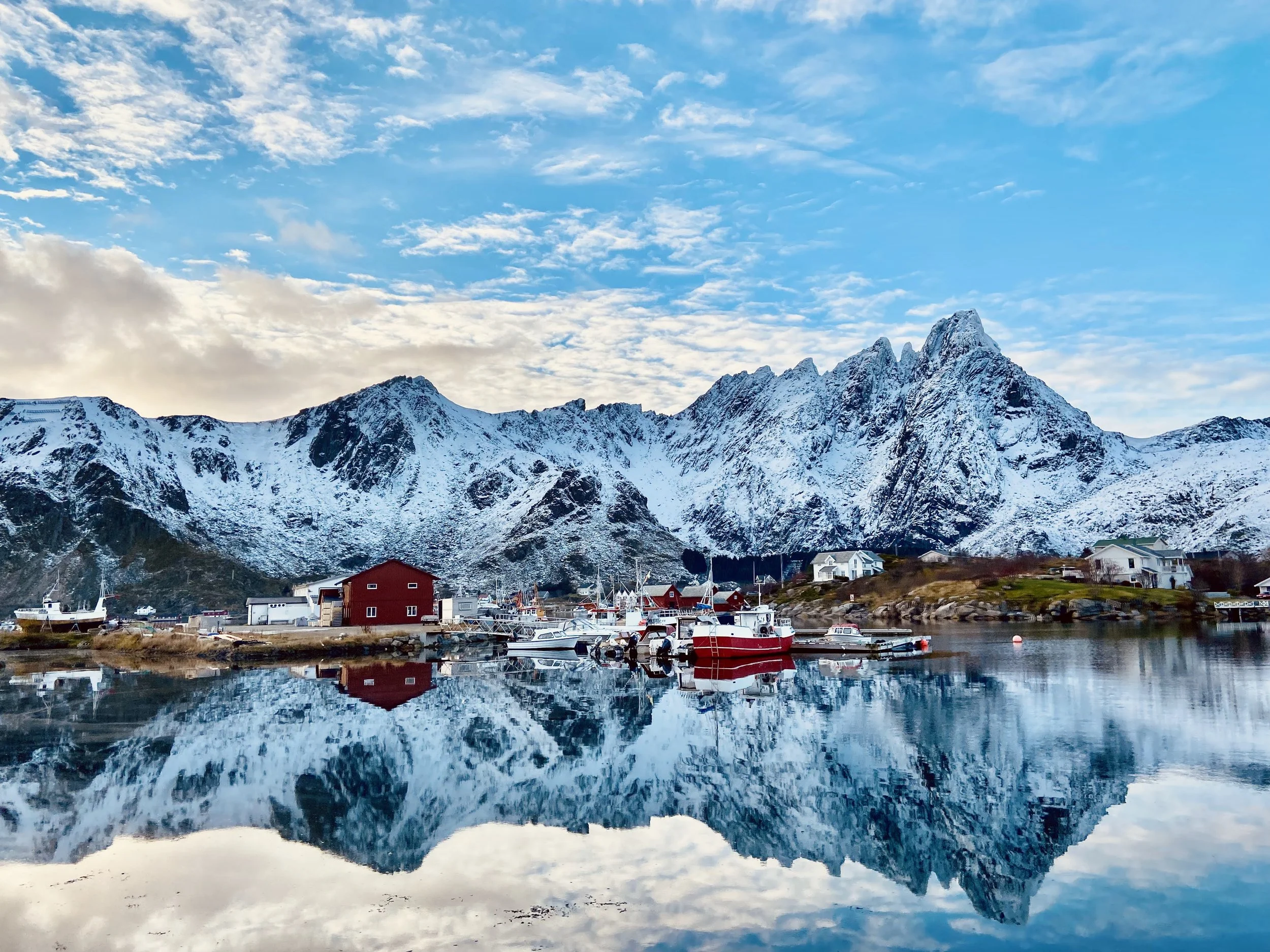
Where to stay for hiking in Lofoten
Wow, the view from our awesome rorbu near Reine
Every accommodation option in Lofoten comes with views that most hotels elsewhere charge significant premiums to approximate. The classic choice is a rorbuer — the traditional red fishing cabin on stilts above the fjord — and they're genuinely as good as they look. Waking up to the sound of water below, coffee with a mountain backdrop, the whole thing.
We've written a detailed guide to the best rorbuer and hotels in Lofoten covering specific properties across the islands including the ones we've personally stayed in. If you're planning your accommodation around the hikes, the guide also notes which properties put you closest to the main trailheads.
Zoom in and out on the map below to find a place to stay in Lofoten:
🦅 Lofoten Wildlife & Sea Life
Lofoten’s waters are alive with orcas, sea eagles, puffins, and whales — especially between October and February when herring fill the fjords near Skrova and Andenes.
If you want to follow their journeys long after you’ve left, check out our partner Fahlo — their Wildlife Bracelets support marine research and let you track real wahles, dolphins, seals and sea turtles around the North Atlantic.
💙🐋 Our readers get 20% off through this link: Track a real whale with Fahlo
✈️ Find flights
🏨 Explore hotels, apartments, guesthouses, cabins
🧭 Browse activities and tours
🚗 Compare car rentals
🧳 Get travel gear
🛡️ Travel safe with Heymondo Travel Insurance (5–15% off)
📱 Get a travel eSIM
🐾 Protect & track Arctic wildlife with Fahlo Bracelets (20% off)
Lofoten hiking: FAQ
What is the best hike in Lofoten Islands?
Reinebringen is the most iconic — the view over Reine is genuinely one of the most spectacular in Norway. If you want fewer crowds and an equally rewarding experience, Ryten delivers a view that's arguably more dramatic, and Offersøykammen near Nappstraumen is a less-visited alternative with a full 360-degree panorama and no exposed ridge.
When is the best time for hiking in Lofoten?
June through September for snow-free trails and long daylight hours. June and early September are the sweet spots for avoiding peak summer crowds. Late September into October is our personal preference — fresh snow on the peaks, fewer people, and moody conditions that make the landscape feel more dramatic.
Do you need a guide for hiking in Lofoten?
Most of the popular trails are self-guided and well-marked. That said, a local guide is worth it for your first visit — they'll calibrate the difficulty to your fitness, know current trail conditions, and show you things you'd miss hiking alone. For challenging or off-trail routes, a guide is strongly recommended.
How difficult is hiking in Lofoten?
Short but steep is the honest summary. Most trails aren't long, but they gain elevation quickly and involve exposed ridges, rocky terrain, and conditions that change without much notice. Solid fitness, comfort on uneven ground, proper waterproof footwear, and no issues with exposure are the baseline requirements for most of the trails on this list.
Is there a Lofoten hiking map I can download?
Yes — Organic Maps and AllTrails both offer downloadable offline maps for Lofoten hiking trails. Download before you go; cell signal on the trails is unreliable. The Norwegian Trekking Association's ut.no platform is also useful for national park trail data.
Can you hike Lofoten in winter?
Some trails yes, some trails absolutely not without serious winter mountaineering experience. Ryten with snowshoes, Røren in light snow, and Mannen in the right conditions are all viable. Reinebringen in winter requires crampons, an ice axe, and experience — it's a genuinely dangerous proposition for most hikers. Read our Lofoten in winter guide before planning a winter hiking trip.
INRK Norwegian Jazz radio was playing when we arrived to the other lovely Rorbu we stayed at - booked last minute for a steal -, so here is a playlist to get you in the mood.
Light a candle, kick off your soaked hiking boots, get a hot chocolate and chillax… In our opinion, life doesn’t get better than this!
It might seem common sense, but respecting nature, being prepared for changing conditions, and embracing the raw beauty of the environment are essential for an unforgettable hiking experience in the mighty, majestic, grandiose — ok, we stop — Lofoten Islands.
Lofoten isn’t the kind of place you visit once. Between hikes, harbors, and skies that never stay the same color twice, it pulls you back. Plan a trip, pack your boots, and you’ll understand why it’s one of the most magical corners of Norway.
If you don’t fall in love, well, we just won’t believe you.
Finally, explore all our Northern Norway Travel Guides here.

Free download
Travel Cheaper Cheat Sheet
27 tips on flights, hotels, hidden costs and more — spend less without missing what actually matters.
No spam. Unsubscribe anytime.
Ready for other adventures in Northern Norway? Check these guides:
🏠 Lofoten Hotels & Rorbuer — Fishermen’s cabins, sea views, and that Arctic calm you’ll wish you could pack home.
❄️ Lofoten in Winter—Is it worth it? A realistic guide to weather, northern lights, and where to stay.
🗓️ Best Time to Visit Lofoten — Month-by-month guide.
⚓ Things to Do in Lofoten — From hiking to kayaking, climbing, camping, sightseeing and even surfing.
🌟 Northern Lights in Lofoten — Seasons, forecast tools, best spots and other tips
🥾 Hiking in Senja — Best trails, including Hesten, Segla & Husfjellet.
⛰️ Alta, Norway — Ice hotels, rock carvings, and one of the best places on Earth to spot the aurora.
🌌 Northern Lights Tours in Alta, Norway — Clear skies, quiet roads, and a front-row seat to the aurora.
🏨 Best Hotels in Tromsø — Cozy stays, fjord views, and a front-row seat to the Northern Lights.
🦌 Alta vs. Tromsø— How to choose the perfect Norwegian Arctic getaway.
🧖♀️ Bodø, Norway — Things to Do — Floating saunas, sea eagles, and the Arctic city everyone skips (and shouldn’t).
❄️ Our Ultimate Arctic Travel Guide — How to explore, survive, and avoid becoming a polar bear’s lunch.
✨ Northern Lights for Dummies — How to actually see the aurora (without freezing your butt off or waiting 12 nights in vain).