
Hiking in the Faroe Islands: the Best Trails and Everything You Need to Know
The wind, the fees, the ferry schedules, and seven hiking trails that are totally worth it.

Sitting on top of the world… well, of Klakkur!
Last update: June 2026
We’re sharing the best hikes in the Faroe Islands — from the floating lake on Vágar to the lighthouse cliffs of Kalsoy, with distances, fees, ferry logistics, weather and everything in between.
We modified hiking plans twice on our last trip to the Faroe Islands because of wind. Not rain — wind. The trail was fine, the visibility was fine, but the gusts at the cliff edge were the kind that make you reconsider your absence of vertigo. We sat it out in the car, ate some dry fish and tried again. We had a plan B. And a plan C. That, more than anything else, is what hiking the Faroe Islands is actually like. Sure, it’s not as cold or crazy as neighboring Iceland, but Atlantic moody weather is real.
If you can work with that — stay flexible, check the weather obsessively, and genuinely enjoy the possibility that your plans will change — then the Faroes offer some of the best hiking in the North Atlantic. Accessible trails. Dramatic coastal scenery on almost every route. Elevation that rewards without making you cry (hello, Lofoten). And a scale that means you can do a couple of hikes in a day if the conditions cooperate.
What follows is our island-by-island breakdown of the hikes in the Faroe Islands we'd actually recommend — with the real distances, the current fee situation, and the ferry logistics.
Quick navigation:
Before you go ·
Vágar: Sørvágsvatn & Trælanípa ·
Kalsoy: Kallur lighthouse ·
Streymoy: Saksun ·
Eysturoy: Slættaratindur & Gjógv ·
Borðoy: Klakkur ·
Mykines ·
Viðoy: Villingardalsfjall ·
Practical tips ·
FAQ
Find a place to stay, a rental car and tours in the Faroe Islands
Before you go: what hiking in the Faroes actually means

The sheep whisperer… here in Kalsoy
A few things worth knowing before you start planning.
The weather is the whole game. Fog, wind, and rain can arrive at any point regardless of season. Trails along cliff edges become dangerous in thick fog or high wind — you lose the visual cues that tell you where the edge is, and the wind can push you. Seriously. Check the Faroese weather service (weather.fo) the morning of every planned hike, not the night before, and prepare a plan B or plan C. Wearing a heavy backpack can help you with the wind, and you might have to crawl.
Most trails now charge a fee. The Faroe Islands introduced paid access to several of its most popular hiking areas, and the list has expanded in recent years. Expect 150–200 DKK per person on most fee trails, typically cash only (bring small bills). A few trails charge 75 DKK. Some have online booking. We've noted the current fee for each trail below — verify before you go as these change.
The Faroes are wetter and muddier than they look in photos. Waterproof boots with real grip are not optional. Poles help on the descent. Trails that look gentle in the promotional shots often have a short but brutally muddy section that will take out anyone in regular trainers.
Hiking here is not technical. Compared to, say, the Lofoten or the Norwegian fjords, most Faroese hiking is accessible to anyone with reasonable fitness and the right footwear. The trails are hills rather than mountains in most cases. The drama comes from the views and the exposure, not the technicality of the route. The difficulty levels indicated here are reasonable, not “Norwegian style” (more on this in our Lofoten hiking article).
Did you know?
The Faroes started charging for trail access when tourism outpaced what the land could handle. Much of the hiking terrain is private grazing land and a surge in visitors was causing real damage: eroded paths, disturbed livestock, fences left open. The fees fund trail maintenance and compensate landowners, and wardens on the busiest routes keep people away from cliff edges that have no guardrails.
Vágar: Sørvágsvatn & Trælanípa
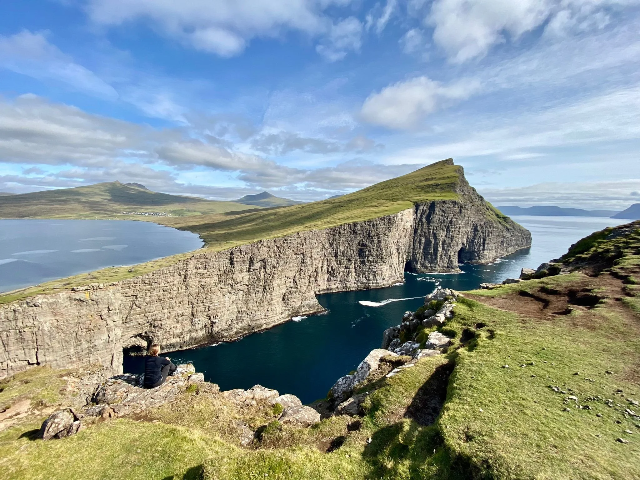
Now, that’s a view!
Distance: 6–8km round trip | Duration: 2–3 hours | Difficulty: Easy to moderate | Fee: 200 DKK per person
This is the one everyone does first, and with good reason. The Sørvágsvatn lake sits on a cliff above the ocean on the western side of Vágar, and from the right angle on the Trælanípa ridge — the cliff where hikers stand for the classic shot — the lake appears to float above the sea. It's a perspective trick created by the cliff height, and it genuinely works. Even knowing the explanation, it looks unbelievable in the best possible way.
The trail starts from a parking lot in Midvagur and is well-marked throughout. The first section follows the lake's edge along relatively flat terrain before the path climbs steeply at the end to reach the Trælanípa viewpoint. From there you can continue to Bøsdalafossur, the waterfall where the lake drains off the cliff into the ocean below — which is, if anything, the more visually interesting destination of the two.
The fee is paid at a small booth near the trailhead during staffed hours. If you arrive outside those hours, there's usually an honesty box. Bring cash.

Penguin tip:
The iconic floating-lake shot requires the right angle and ideally some distance from the cliff edge. Walk further along the ridge than you think you need to — the perspective only works from a specific zone, and most people stop too early.
Find activities and tours in Vagar:
Explore hotels, cabins and apartments in Vagar:
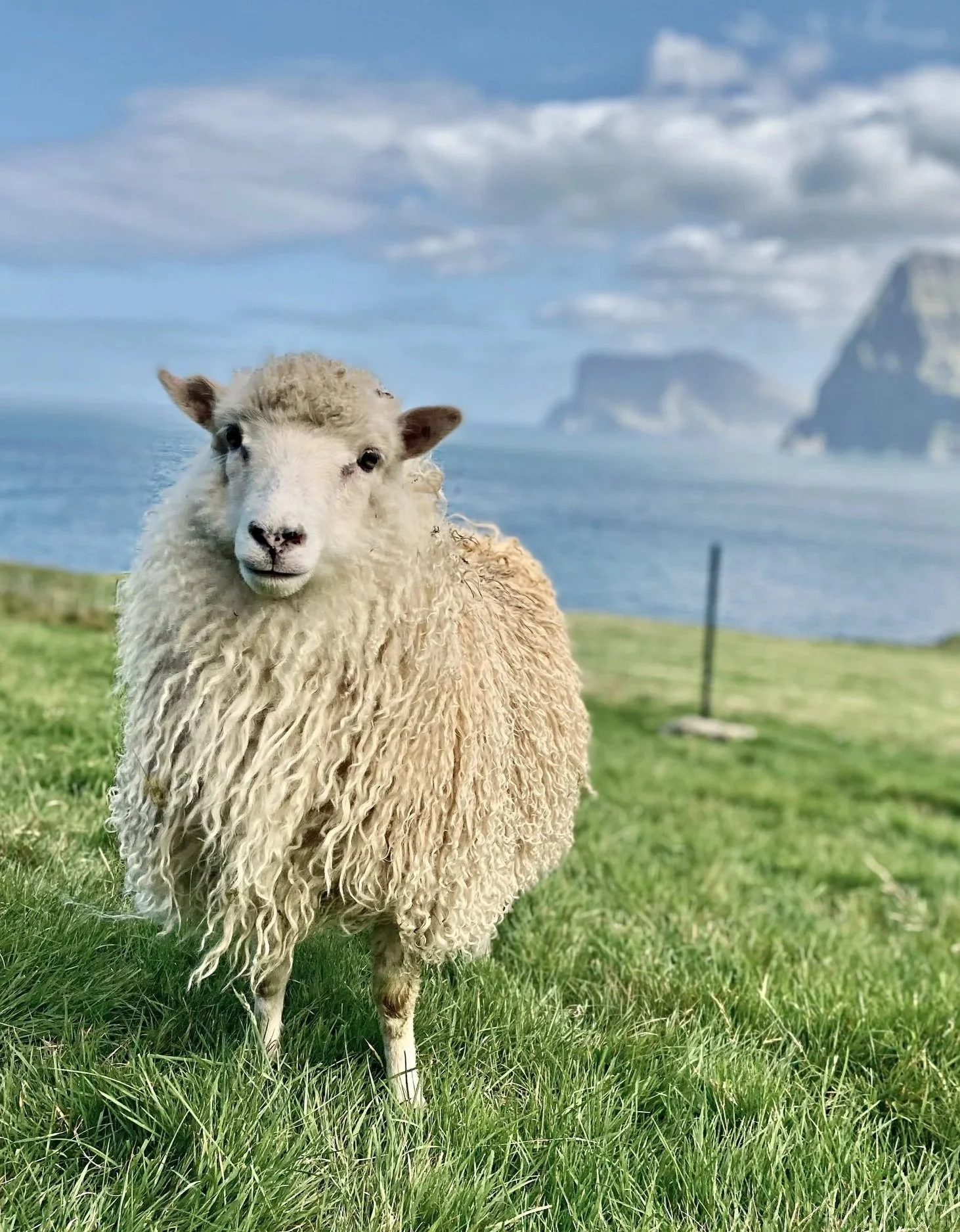
Kalsoy: Kallur lighthouse

Had to crawl due to the wind, but the view was worth it!
Distance: ~4km round trip | Duration: 1.5–2 hours (but allow more to soak in the views) | Difficulty: Easy to moderate | Fee: 200 DKK per person
Kalsoy is a long, thin island reached by ferry from Syðradalur on Borðoy. The ferry takes about 20 minutes and has a maximum capacity of 17 cars — which means on summer weekends, you either arrive early or you wait for the next one (or the one after that). Ferries run a few times a day. Check the schedule at ssl.fo and don't count on walking on.
Once on Kalsoy, a single road runs north through a series of tunnels to the village of Trøllanes, where the Kallur hike starts from the parking lot. The trail is mostly grassy hillside — muddy in sections, but nothing serious — and reaches the lighthouse in around 40 minutes, passing amazingly picturesque sheep with a view. The lighthouse itself is fine. The real reason to do this hike is to continue past it to the cliff edge on the far side, where the terrain drops away dramatically and you're looking out over open Atlantic with nothing between you and Canada.
We watched the weather for a few days and got lucky with a sunny (although windy) day. Purely spectacular.
One of us maintains this is the best hike in the Faroe Islands. The other isn’t prepared to rank them. We are married, which means we've reached a productive stalemate.
Streymoy: Út á Lónna, Saksun
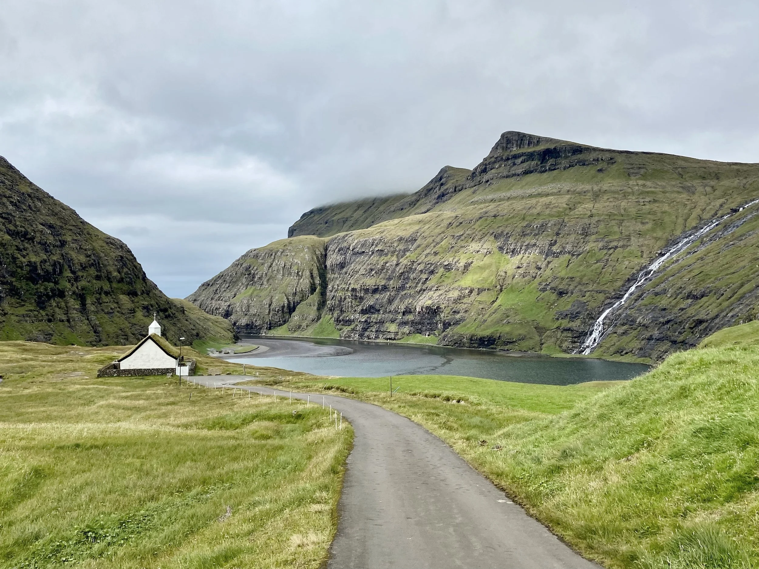
Saksun is so picturresque!
Distance: 6km | Duration: 1.5–2 hours | Difficulty: Easy | Fee: 75 DKK per person
Saksun is the village that looks like it was designed specifically to make visitors lose the ability to speak. Seriously, it’s just too pretty. A cluster of turf-roofed houses at the end of a winding valley, a 17th-century church on the hillside, and — at low tide — a black sand tidal lagoon surrounded by cliffs where the sea pushes in through a narrow channel. The hiking here is gentler than most Faroese trails, which makes it a good option for mixed-ability groups, families with young children, or a slower afternoon.
The Út á Lónna walk starts from the first parking lot before the bridge entering Saksun. The trail follows the edge of the lagoon and takes you across the black sand beach at its heart — accessible for roughly three hours either side of low tide, so check the tide times before you go. The fee is lower than most, and the walk itself is more of a long stroll than a proper hike, but the landscape it moves through earns its place on the list.
Important warning: Saksun is one of the most visited spots on Streymoy, and the parking lot fills up fast in summer. Go early or go late. The light is better at both ends of the day anyway. When we went early September, we didn’t have any issue. It’s also a great spot for northern lights (included in our guide to the northern lights in the Faroe Islands).
Eysturoy: Slættaratindur and the Gjógv ridge

Our plan B turned out to be lovely too… and a bit safer that day!
Eysturoy has two very different hiking moods. One is the highest mountain in the Faroes. The other is a gentle ridge walk above one of the most photographed villages in the archipelago. We tried to do the first one, and we had to abort and go for the second one due to high winds and strong sleet.
Slættaratindur — the highest point
Distance: ~8km round trip (or shorter from the Eiðisskarð pass) | Duration: 2–3 hours | Difficulty: Moderate | Fee: required (non-residents)
At 880 meters, Slættaratindur is the highest peak in the Faroe Islands. That's not Himalayan territory, but the summit views — on a clear day — take in almost the entire archipelago. The most common approach starts from the Eiðisskarð mountain pass, which cuts the elevation gain significantly and brings the round trip down to well under 8km. The climb from the pass to the summit is straightforward on good terrain, with one steeper section near the top.
Cloud is the main variable. The summit sits above the cloud line often enough that you should genuinely consider delaying a day if the forecast looks uncertain — there's no point standing at 880 meters staring into white.
Hvithamar above Gjógv
Distance: 2–3km round trip | Duration: 1 hour | Difficulty: Easy | Fee: none currently
Gjógv is a village on the northeast tip of Eysturoy built around a natural gorge — gjógv means gorge in Faroese — where the sea pushes in through a dramatic crack in the cliff. The short ridge walk above the village (sometimes marked as Hvithamar or Gongutúrur) takes about an hour return and offers a perspective over the gorge and out to the northern islands that stops being interesting roughly never (and these cuuuute sheeeep). No fee, no ferry logistics, no crowds. Do it in the late afternoon when the north light is doing its thing.
Borðoy: Klakkur above Klaksvík
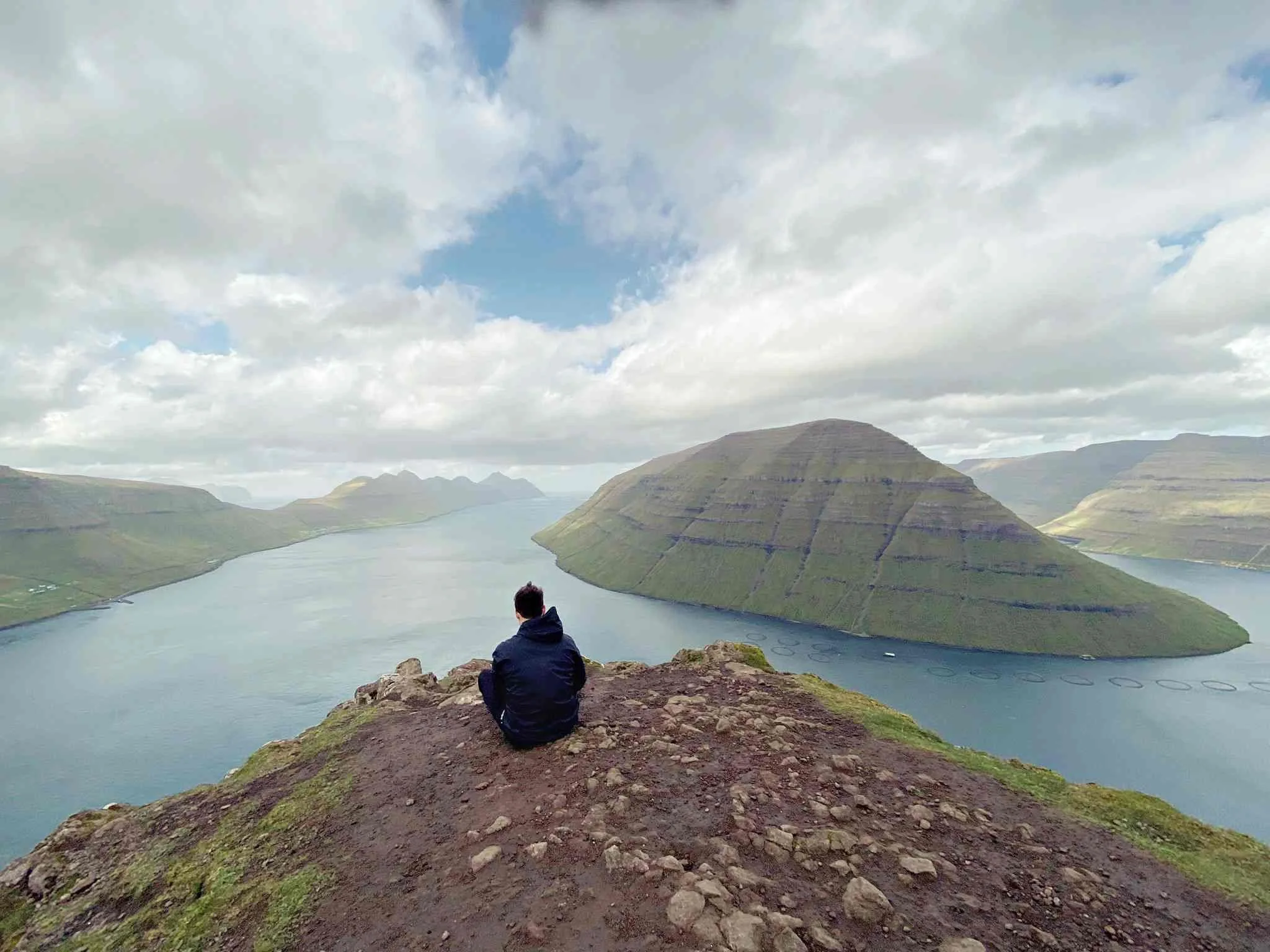
We’d love to see this with snow!
Distance: 3–10km depending on start point | Duration: 1.5–3.5 hours | Difficulty: Moderate | Fee: none currently
Klakkur is the mountain that sits directly above Klaksvík, and hiking it is one of those things that feels obvious once you're in town. The summit is at 413 meters, which doesn't sound like much until you're standing on it looking down at the town and the two fjords it sits between, with the crazy round-shaped outer islands spread out in every direction.
There are two approaches. The shorter route starts higher up (from the parking area near the church) and takes about 1.5 hours return. The longer route starts from the town center and adds an extra hour or so each way — but the walk out of Klaksvík itself is worth something. The trail runs partly on road and partly on grass, and the section called Ástarbreytin (which translates, with perfect Faroese matter-of-factness, as "Love Path") cuts between the two fjords before the real climbing begins.
We cover Klaksvík in more detail in our guide to where to stay in Klaksvík — it's one of the most underrated bases in the Faroes for anyone planning to hike the northern islands.
Mykines: the whole island
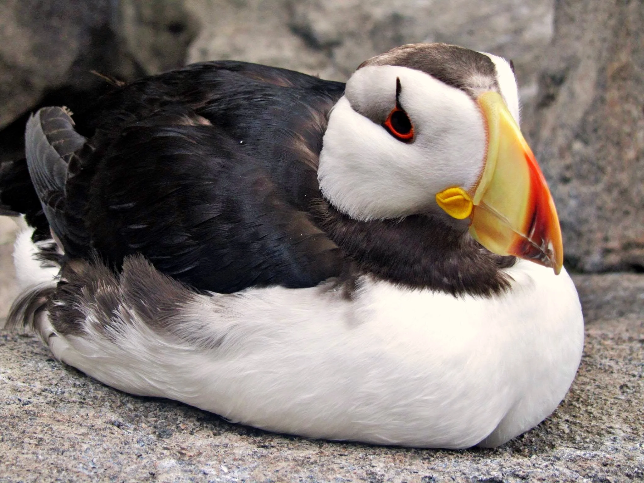
We took this picture in Alaska, but we would love to see puffins in the Faroe Islands!
Distance: 7–8km | Duration: 2.5–3 hours | Difficulty: Moderate | Fee: charged on arrival
Mykines is the westernmost island in the archipelago, and getting there is part of the experience. Unfortunately, the ferry wasn’t running anymore when we went there, so we'll have to leave it for our next visit. Indeed, the ferry from Sørvágur runs from May through August and is weather-dependent — cancellations are common, including same-day cancellations, and the boat fills up fast. Book ahead and build in a contingency day. The helicopter from Vágar Airport is an alternative but expensive and also weather-dependent.
The walk across the island from the village to the lighthouse at the western end takes most of the round trip time, crossing open moorland, passing nesting seabirds at close range, and — in the right season — moving through what is genuinely one of the largest Atlantic puffin colonies in the world. The birds arrive around April and leave in August, and in peak season they are everywhere: on the cliffsides, on the grass, standing in a line on a fence post giving you a look.
A note on the lighthouse path: as of our last update, the footbridge connecting the main island to Mykinesholmur — the small islet where the lighthouse sits — was closed due to a landslide. Check the current status before you go, as this is a significant chunk of the walk.
A word of warning: If your ferry gets cancelled and you're stuck on Mykines overnight, you're stuck on Mykines overnight. Some people consider this a disaster. Others consider it exactly the kind of thing that makes a trip memorable. Pack accordingly.
Viðoy: Villingardalsfjall for the serious hiker
Distance: 6km round trip | Duration: 3–4 hours | Difficulty: Moderate to difficult | Fee: 200 DKK per person
Most people who visit the northern islands come for Kalsoy. Fewer make it to Viðoy and the trail from Viðareiði up to Villingardalsfjall at 841 meters. That's probably fine — this is a proper climb, steep throughout, and the kind of hike where turning back early is always a reasonable option. The reward is views over the northern islands that most visitors to the Faroes never see, including the Enniberg cliffs — among the highest sea cliffs in the world — directly to the north.
Start north of the village of Viðareiði. The fee is collected at a small booth. If the cloud is sitting at 500 meters when you arrive, come back tomorrow.
Need an accommodation near the trails? Zoom in and out on the map below to find your dream house or hotel in the Faroe Islands:
Practical tips for hiking in the Faroe Islands
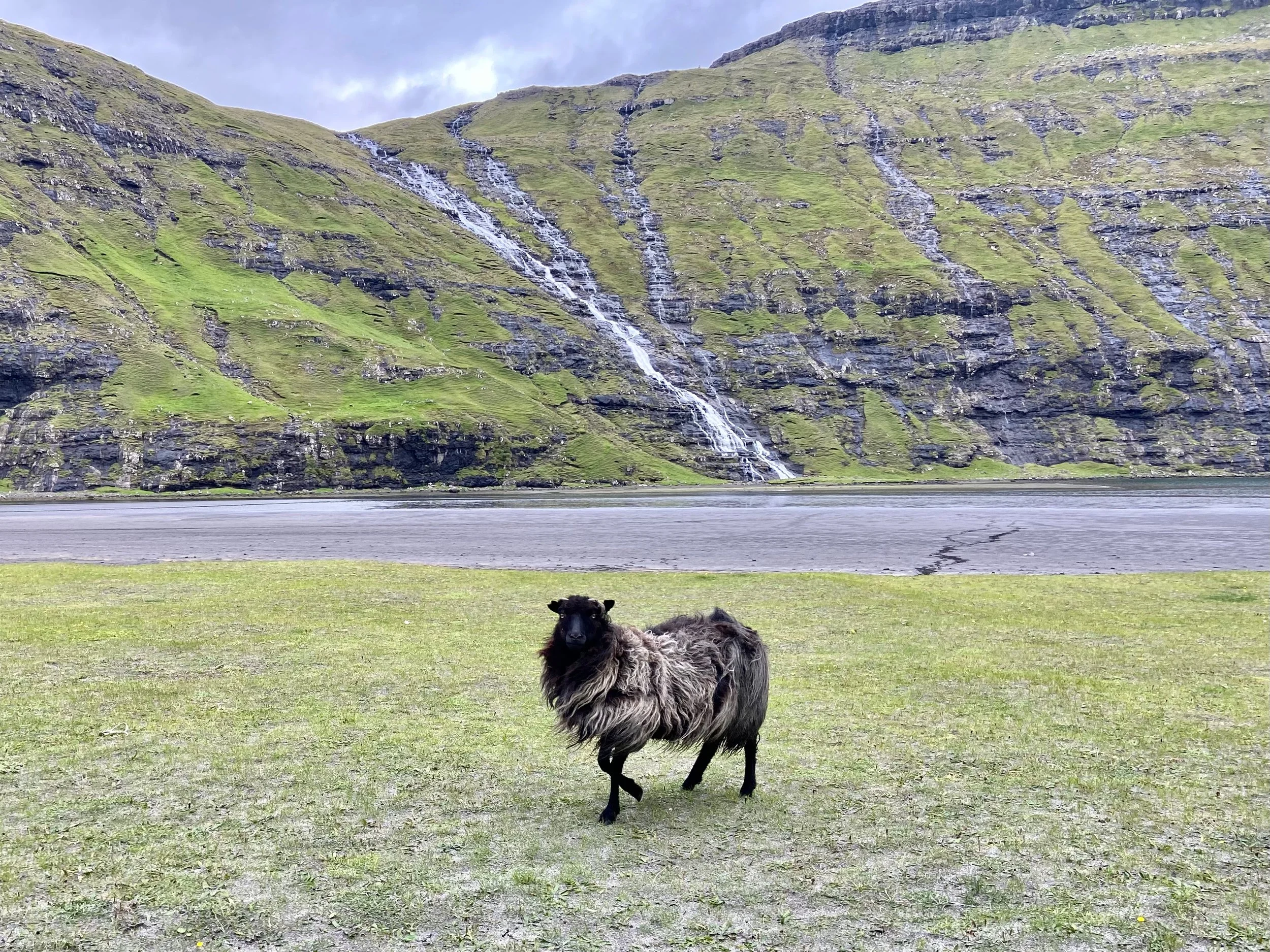
Wherever you go, the sheep own the place. Look at this fluff!
Gear
Waterproof boots, waterproof jacket, extra layer. Poles on anything longer than 5km. That's really it — the Faroes don't require specialist equipment, just the basics done properly.
Fees
Most popular trails now charge 150–200 DKK (around €20). Cash only on most routes, so carry enough before you leave your base. The fee system was introduced partly to fund trail maintenance and limit erosion on overused routes — the money genuinely goes back into the trails.
Weather
weather.fo for daily forecasts. Wind is the bigger danger on cliff-edge trails, not rain. If gusts above 15–20 m/s are forecast, seriously consider a different plan for the day.
When to hike
May through September is the main hiking window. June and July have the longest light — you can hike at 10pm and still see everything. August and September bring slightly lower crowds and, in September, the first hint of autumn color on the moorland. Check our guide to the best time to visit the Faroe Islands.
Hiking tours
If you'd rather not navigate ferry schedules and trail fees independently, guided hiking tours are available out of Tórshavn and Vágar. These work particularly well for Mykines and the northern islands, where logistics can get complicated. You can browse tours through GetYourGuide and Viator.
You need a car
The islands are connected by tunnels, bridges, and ferry crossings, and most trailheads are only accessible by car. Car hire is available at Vágar Airport and in Tórshavn.
Where to stay. Accommodation is as dreamy as the surrounding landscape. Read our guide to the best hotels, boathouses and apartments in the Faroe Islands.
Travel insurance
Hiking in the Faroe Islands involves (very) unpredictable Atlantic weather. Make sure your policy covers hiking and activity-based travel (more on this in our Insurance for hiking guide). We use and recommend Heymondo, and you get 5-15% off if you book via our link.
✈️ Find flights
🏨 Explore hotels, apartments, guesthouses, cabins
🧭 Browse activities and tours
🚗 Compare car rentals
🧳 Get travel gear
🛡️ Travel safe with Heymondo Travel Insurance (5–15% off)
📱 Get a travel eSIM
🐾 Protect & track the Faroes'wildlife with Fahlo Bracelets (20% off)
Note on travel eSIM: The Faroe Islands are outside EU free roaming. Like Greenland, the Faroes are a self-governing territory of Denmark but have never been part of the EU, and the Roam Like at Home regulation doesn't apply here. EU travelers should expect standard international roaming rates, which over a week-long trip — especially one built around chasing the northern lights and driving between islands in the dark — add up to a cost that a travel eSIM avoids entirely.
FAQ: Hiking in the Faroe Islands
Is hiking in the Faroe Islands difficult?
Most popular trails are accessible to anyone with reasonable fitness and proper footwear. The Faroes are hills rather than mountains in most cases — even the highest peak, Slættaratindur at 880m, is a moderate hike on good terrain. The main challenge is weather and exposure on cliff-edge trails, not technical difficulty.
Do you need to pay to hike in the Faroe Islands?
Many popular trails now charge a fee — typically 150–200 DKK per person, cash only. This includes trails like Sørvágsvatn/Trælanípa on Vágar, Kallur on Kalsoy, and Villingardalsfjall on Viðoy. Some trails, like Klakkur above Klaksvík and Hvithamar above Gjógv, are currently free. The system changes, so verify current fees before you go.
What is the best hike in the Faroe Islands?
Depends what you're after. Sørvágsvatn on Vágar is the most iconic. Kallur on Kalsoy is the most dramatic for coastline. Mykines is the most remote and wildlife-rich. Klakkur above Klaksvík is the most accessible if you're based in the north. We'd probably pick Kallur, but we've had this argument before and haven't resolved it.
When is the best time to hike the Faroe Islands?
June to September. June and July have the most daylight — hiking at 10pm is entirely possible. August has good conditions with slightly fewer visitors. Late May works too but some trails may still be wet from winter. Our full guide to the best time to visit the Faroe Islands covers the tradeoffs by month in detail.
Do you need a car to hike in the Faroe Islands?
For most trails, yes. The islands are connected by an impressive road network (including several subsea tunnels), but trailheads are generally not accessible without a vehicle. A few hikes — like Klakkur from Klaksvík town — can be started on foot. Kalsoy and Mykines require ferries regardless of whether you have a rental car.
Are there guided hiking tours in the Faroe Islands?
Yes — several operators offer guided hiking tours from Tórshavn and Vágar, covering trails from half-day walks to multi-day routes. These are useful if you want to skip the logistics on ferry-dependent islands like Mykines or Kalsoy. Book in advance for summer, especially for Mykines.
Here is a playlist to get into the Faroese magic:
As in other of our favorite places in the world, it’s worth being patient with the weather. That's the Faroe Islands, really — it makes you slow down until you're on its schedule. Most of the best moments happen then.
We fell in love with these small but mighty islands in the middle of the Atlantic, and we can’t wait to try more hiking trails.
And for logistics, where to stay and other things to do, read our Faroe Islands Travel Guide our all our Faroe Islands articles.

Free download
Travel Cheaper Cheat Sheet
27 tips on flights, hotels, hidden costs and more — spend less without missing what actually matters.
No spam. Unsubscribe anytime.
Planning to visit other of our favorite islands up north?
🌊 Faroe Islands Guide — Clifftop hikes, puffins, waterfalls, and the place we chose to unofficially get married.
🏨 Places to Stay in the Faroe Islands — Hotels in Tórshavn & beyond
🏠 Where to Stay in Klaksvík — Hotels and dreamy boathouses, including Kalsøy.
🇫🇴 Best Time to Visit the Faroe Islands — Month-by-month guide.
✨ Northern Lights in the Faroe Islands — Can you see them, where to go and our best tips.
⛏️ Hiking in Senja — Best trails, including Hesten, Segla & Husfjellet.
🌋 Iceland Guide — Volcanoes, waterfalls, and the road trip of your geothermal dreams.
🏨 Best Northern Lights Hotels in Iceland — Cozy cabins, glass igloos, and wild skies where the aurora dances right above your bed.
🧊 Svalbard & Jan Mayen — Polar bears, ghost towns, and next-level Arctic mystery in Norway’s far north.
⛰️ Lofoten Hiking Guide — Dramatic ridges, secret beaches, and cod-drying racks in Arctic Norway.
🏠 Lofoten Hotels & Rorbuer — Fishermen’s cabins, sea views, and that Arctic calm you’ll wish you could pack home.
🐋 Greenland Travel Guide — Icebergs, ferries, and Inuit traditions in the wildest place we’ve ever been.